LANDSCAPE APPROACH
Four zones.
One clear map.
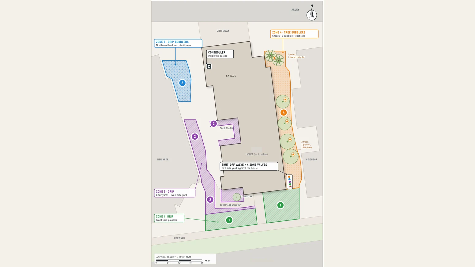
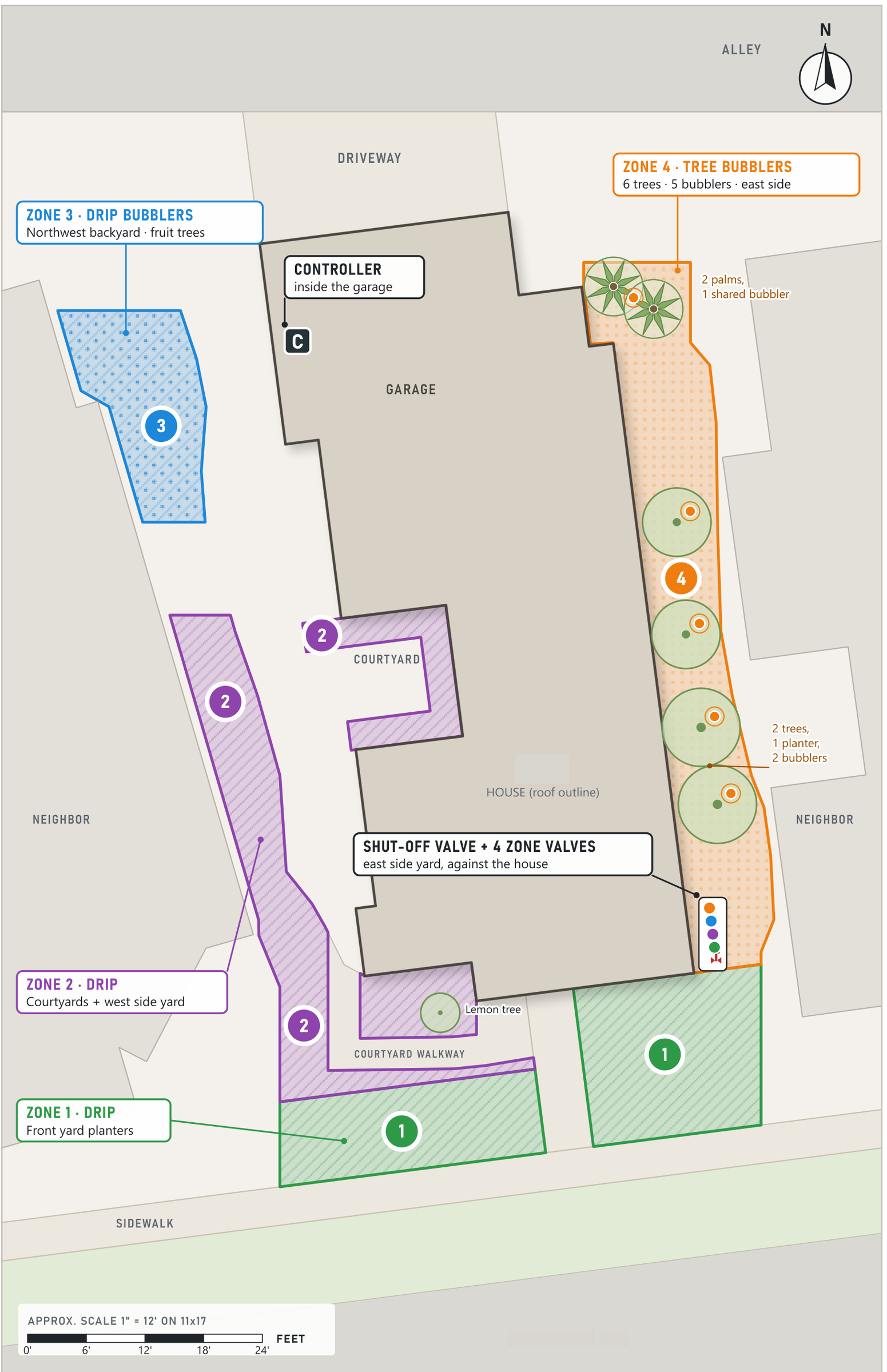
For a residence in Carlsbad, irrigation zones, valves and the controller were brought together in one clear map. The task translated the installer’s knowledge into a record the homeowner could easily use day to day.
READING THE SPACE
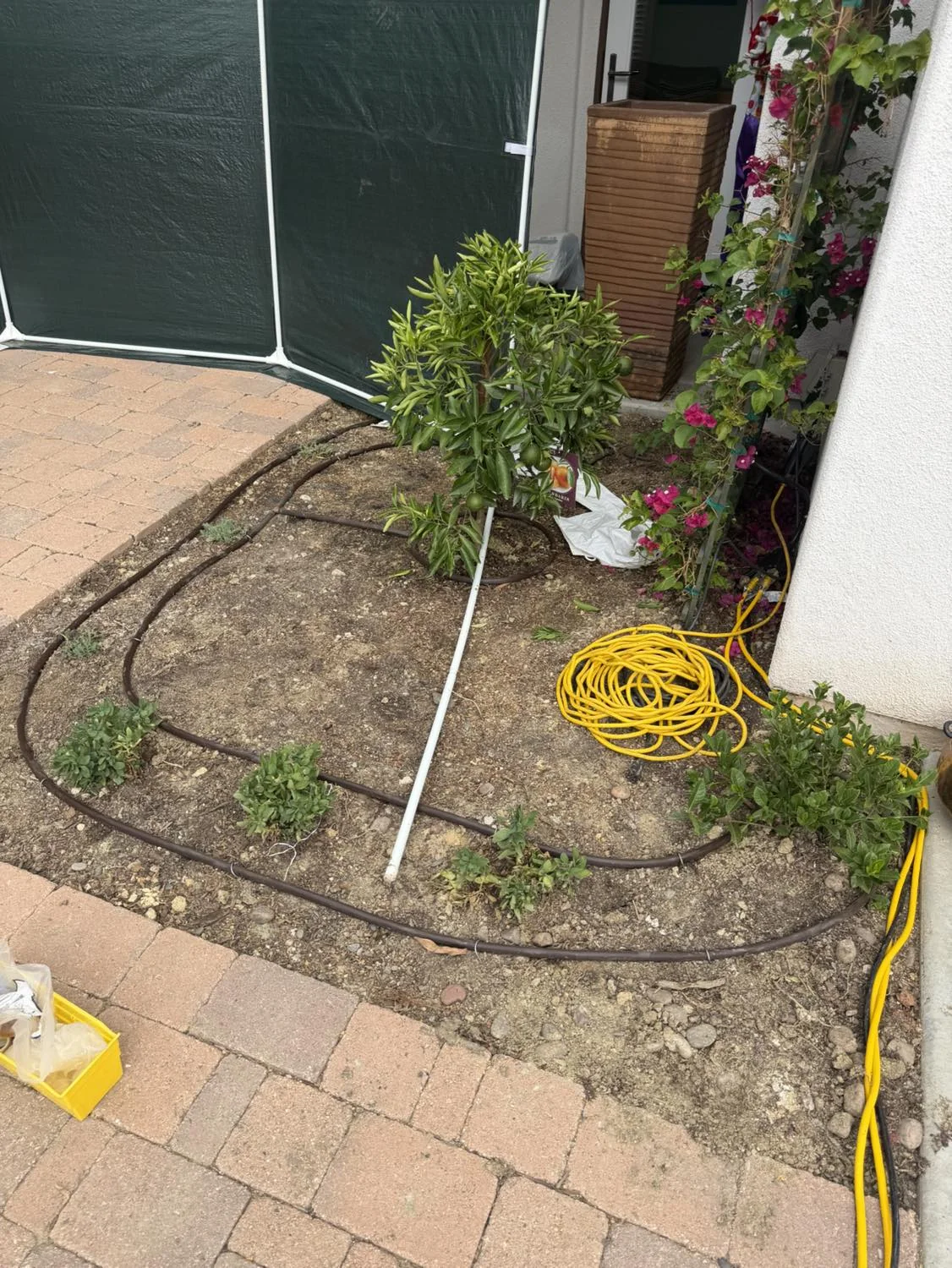
The front garden.
Its place on the map.
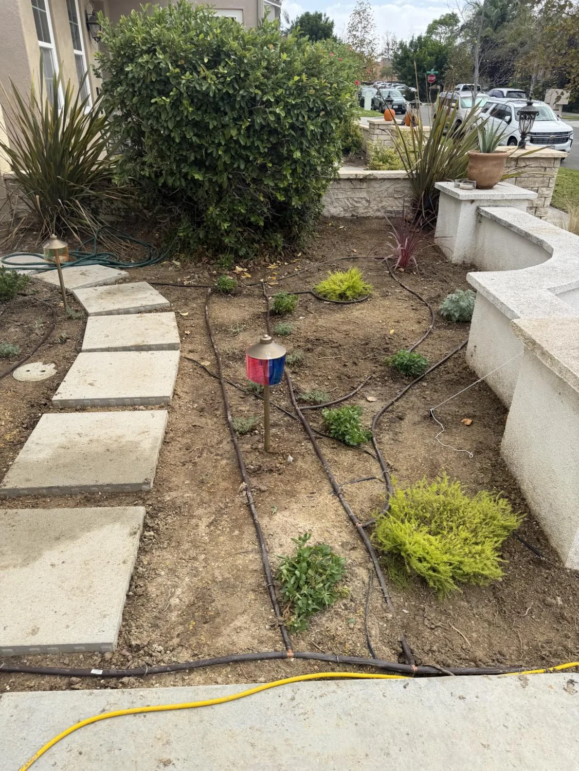
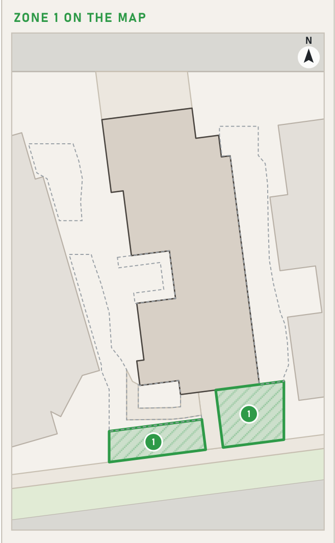
The front-garden site photograph and zone plan show the same area at two scales. Linking the planted area with its control zone makes the irrigation system easier to understand.
- Area — the planted bed shown in the photograph.
- Zone — the control area located in plan.
- Purpose — a clear reference for the homeowner.
READING THE SPACE
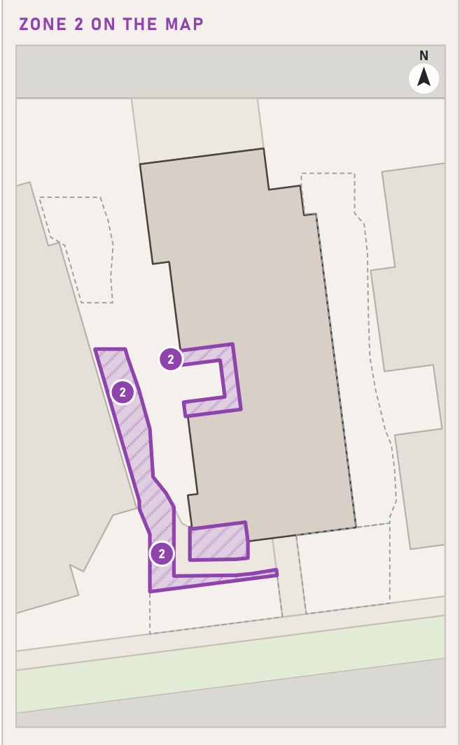
The courtyard.
Its control zone.
Courtyard planting is read alongside its zone plan. The connection between photograph and drawing makes it clear which irrigation control serves each area.
- Area — the planted bed shown in the photograph.
- Zone — the control area located in plan.
- Purpose — a clear reference for the homeowner.
PLAN AND DETAIL
Clear records.
Easier use.
Two drip zones, a fruit-tree drip-bubbler zone and a tree-bubbler zone are distinguished within one reference system. Editable drawings and readable sheets form complementary parts of the completed documentation.
Zones
Clear identification of four irrigation areas.
Control
Valve and controller references.
Handoff
Editable drawings and readable sheets.
PROJECT CONTRIBUTION
Project.
My role.
Irrigation-zone mapping, CAD and documentation coordination: Zümra Timur. Site photographs: installer. Map base: OpenStreetMap contributors / ODbL and USDA NAIP.